- Claysville S Bridge
-
"S" BridgeWashington County History & Landmarks Foundation Landmark
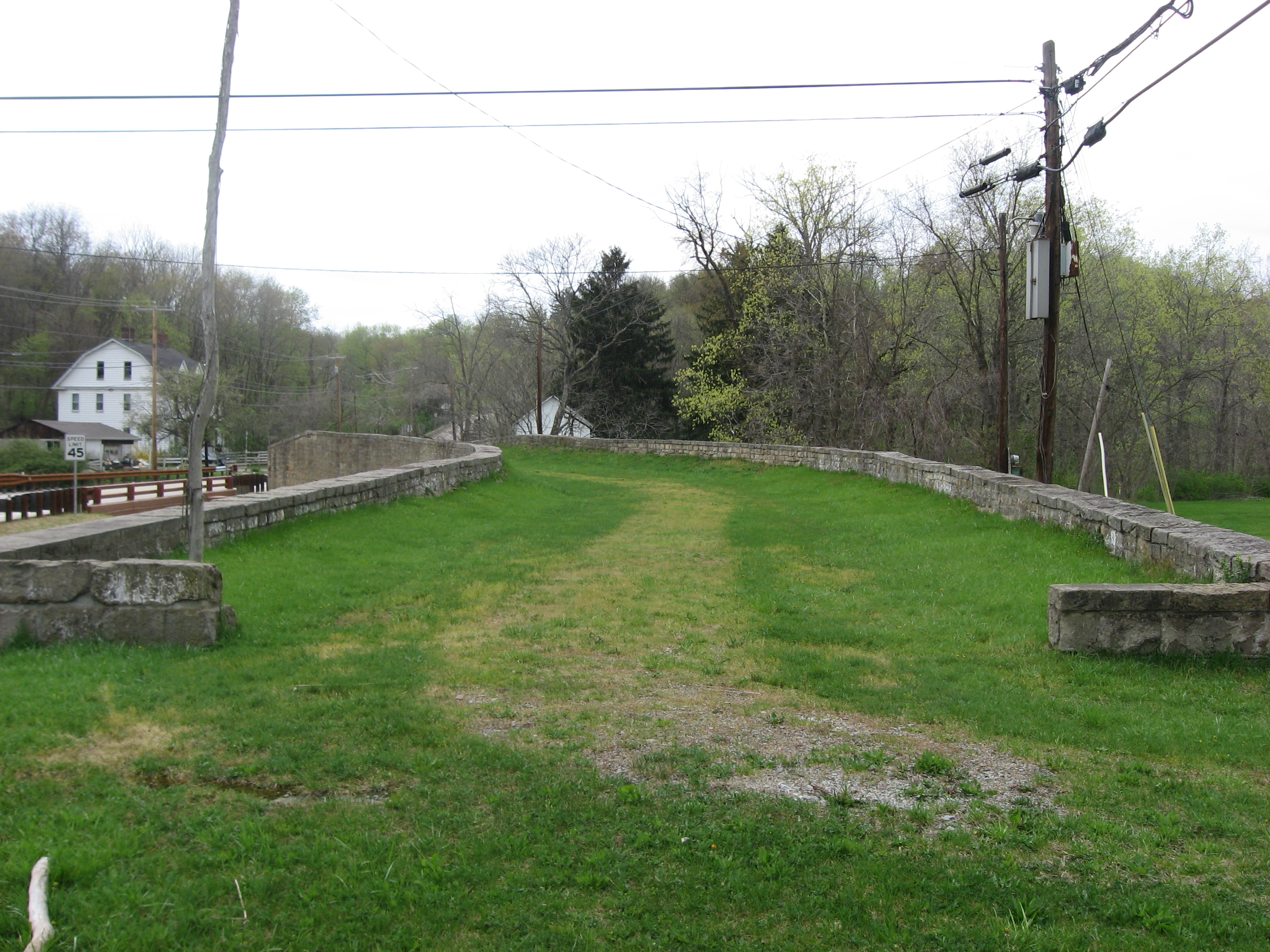
 Eastern end of the bridge

Nearest city: Washington, Pennsylvania Coordinates: 40°8′22″N 80°21′0″W / 40.13944°N 80.35°WCoordinates: 40°8′22″N 80°21′0″W / 40.13944°N 80.35°W Area: 1 acre (0.40 ha) Built: 1818 Governing body: Local NRHP Reference#: 75001676[1] Added to NRHP: April 04, 1975 The Claysville "S" Bridge is a historic S bridge in Washington County, Pennsylvania.
It is designated as a historic bridge by the Washington County History & Landmarks Foundation.[2]
References
- ^ "National Register Information System". National Register of Historic Places. National Park Service. 2009-03-13. http://nrhp.focus.nps.gov/natreg/docs/All_Data.html.
- ^ "S Bridge". Landmark Registry - Bridges. Washington County History & Landmarks Foundation. 2008. http://www.washcolandmarks.com/landmark_registry_display.php. Retrieved 2010-11-08.
U.S. National Register of Historic Places Topics Lists by states Alabama • Alaska • Arizona • Arkansas • California • Colorado • Connecticut • Delaware • Florida • Georgia • Hawaii • Idaho • Illinois • Indiana • Iowa • Kansas • Kentucky • Louisiana • Maine • Maryland • Massachusetts • Michigan • Minnesota • Mississippi • Missouri • Montana • Nebraska • Nevada • New Hampshire • New Jersey • New Mexico • New York • North Carolina • North Dakota • Ohio • Oklahoma • Oregon • Pennsylvania • Rhode Island • South Carolina • South Dakota • Tennessee • Texas • Utah • Vermont • Virginia • Washington • West Virginia • Wisconsin • WyomingLists by territories Lists by associated states Other Categories:- Bridges on the National Register of Historic Places in Pennsylvania
- Buildings and structures completed in 1818
- Bridges in Washington County, Pennsylvania
- Road bridges in Pennsylvania
- Pennsylvania Registered Historic Place stubs

Wikimedia Foundation. 2010.