- Church End, Totternhoe
-
Coordinates: 51°52′11″N 0°33′37″W / 51.86971°N 0.5603°W
Church End 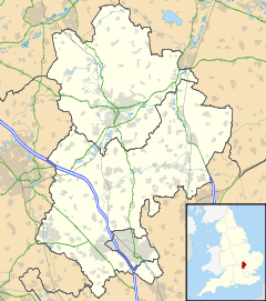
 Church End
Church End shown within BedfordshireOS grid reference SP992199 Parish Totternhoe Unitary authority Central Bedfordshire Ceremonial county Bedfordshire Region East Country England Sovereign state United Kingdom Post town DUNSTABLE Postcode district LU6 Dialling code 01582 Police Bedfordshire Fire Bedfordshire and Luton Ambulance East of England EU Parliament East of England UK Parliament South West Bedfordshire List of places: UK • England • Bedfordshire Church End is a hamlet located in Bedfordshire, England.
The settlement forms part of the wider Totternhoe village and civil parish, with Church End being the closest part of the parish to the larger town of Dunstable. Totternhoe Lower School is located in Church End, as is "The Old Farm Inn" public house.
Categories:- Villages in Bedfordshire
- Bedfordshire geography stubs

Wikimedia Foundation. 2010.