- Chom Phra District
-
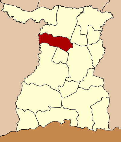
Chom Phra
จอมพระ— Amphoe — Amphoe location in Surin Province
Coordinates: 15°7′3″N 103°36′41″E / 15.1175°N 103.61139°ECoordinates: 15°7′3″N 103°36′41″E / 15.1175°N 103.61139°E Country  Thailand
Province Surin Seat Tambon Muban Amphoe established Area - Total 314.0 km2 (121.2 sq mi) Population (2005) - Total 60,568 - Density 192.9/km2 (499.6/sq mi) Time zone THA (UTC+7) Postal code 32180 Geocode 3204 Chom Phra (Thai: จอมพระ) is a district (Amphoe) in the northern part of Surin Province, northeastern Thailand.
Geography
Neighboring districts are (from the north clockwise) Tha Tum, Sanom, Sikhoraphum, Khwao Sinarin and Mueang Surin of Surin Province, and Satuek of Buriram Province.
History
The minor district (King Amphoe) Chom Phra was established in 1959, when it was split off from Tha Tum district. On July 27 1965 it was upgraded to a full district.
Administration
The district is subdivided into 9 subdistricts (tambon), which are further subdivided into 105 villages (muban). Chom Phra is a township (thesaban tambon) which covers parts of tambon Chom Phra. There are further 9 Tambon administrative organizations (TAO).
No. Name Thai name Villages Inh. 1. Chom Phra จอมพระ 15 10,471 2. Mueang Ling เมืองลีง 18 10,729 3. Krahat กระหาด 9 3,979 4. Bu Kraeng บุแกรง 15 7,912 5. Nong Sanit หนองสนิท 10 6,918 6. Ban Phue บ้านผือ 11 5,599 7. Lum Rawi ลุ่มระวี 10 4,841 8. Chum Saeng ชุมแสง 7 4,978 9. Pen Suk เป็นสุข 10 5,141 Mueang Surin · Chumphon Buri · Tha Tum · Chom Phra · Prasat · Kap Choeng · Rattanaburi · Sanom · Sikhoraphum · Sangkha · Lamduan · Samrong Thap · Buachet · Phanom Dong Rak · Si Narong · Khwao Sinarin · Non Narai
Categories:- Amphoe of Surin
- Isan geography stubs
Wikimedia Foundation. 2010.