- Chiang Muan District
-
Chiang Muan
เชียงม่วน— Amphoe — Amphoe location in Phayao Province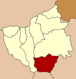
Coordinates: 18°53′12″N 100°18′12″E / 18.88667°N 100.30333°ECoordinates: 18°53′12″N 100°18′12″E / 18.88667°N 100.30333°E Country  Thailand
Province Phayao Seat Chiang Muan Tambon Muban Amphoe established Area - Total 722.860 km2 (279.1 sq mi) Population (2005) - Total 19,122 - Density 26.5/km2 (68.6/sq mi) Time zone THA (UTC+7) Postal code 56160 Geocode 5604 Chiang Muan (Thai: เชียงม่วน; IPA: [tɕʰīaŋ mûan]) is a district (Amphoe) in the southern part of Phayao Province, northern Thailand.
Contents
History
Chiang Mun was originally part of the district Ban Muang of Chiang Rai Province (which was later renamed to Pong district). On May 12, 1969 the minor district (King Amphoe) Chiang Mun was established as a subordinate of Pong district, consisting of the two tambon Chiang Muan and Sa.[1] On April 1, 1974 it was upgraded to a full district. In 1977 it was added to the newly established Phayao province.[2]
Geography
Neighboring districts are (from the west clockwise) Dok Khamtai, Pong of Phayao Province, Ban Luang of Nan Province and Song of Phrae Province.
The important water resource is the Yom River.
The Doi Phu Nang National Park is located in Chiang Muan district.
Education
Most notably, Amphoe Chiang Muan received a large governmental grant for the furthering of rural educational services in the Phayao region. The funding was subsequently used in the construction of the Chiang Muan Wittayakhom School, an advanced junior/senior public highschool which services grades 6-12.
Administration
The district is subdivided into 3 subdistricts (tambon), which are further subdivided into 34 villages (muban). Chiang Muan is a township (thesaban tambon) which covers most of tambon Chiang Muan and parts of Ban Mang. The non-municipal area of tambon Ban Mang and tambon Sa are each led by a Tambon administrative organization (TAO).
No. Name Thai name Villages Inh. 1. Chiang Muan เชียงม่วน 10 7,261 2. Ban Mang บ้านมาง 11 5,929 3. Sa สระ 13 6,352 References
- ^ "ประกาศกระทรวงมหาดไทย เรื่อง แบ่งท้องที่ตั้งเป็นกิ่งอำเภอ" (in Thai). Royal Gazette 86 (44 ง): 1729. May 20, 1969. http://www.ratchakitcha.soc.go.th/DATA/PDF/2512/D/044/1728.PDF.
- ^ "พระราชกฤษฎีกาตั้งอำเภอเขาวง อำเภอเชียงม่วน อำเภอดอนตาล อำเภอชาติตระการ อำเภอภูเรือ อำเภอเคียนซา อำเภอน้ำโสม อำเภอหนองวัวซอ และอำเภอน้ำยืน พ.ศ. ๒๕๑๗" (in Thai). Royal Gazette 91 (54 ก special issue): 30–33. March 28, 1974. http://www.ratchakitcha.soc.go.th/DATA/PDF/2517/A/054/30.PDF.
External links
Mueang Phayao · Chun · Chiang Kham · Chiang Muan · Dok Khamtai · Pong · Mae Chai · Phu Sang · Phu KamyaoCategories:- Amphoe of Phayao
- Northern Thailand geography stubs

Wikimedia Foundation. 2010.