- Matadi–Kinshasa Railway
-
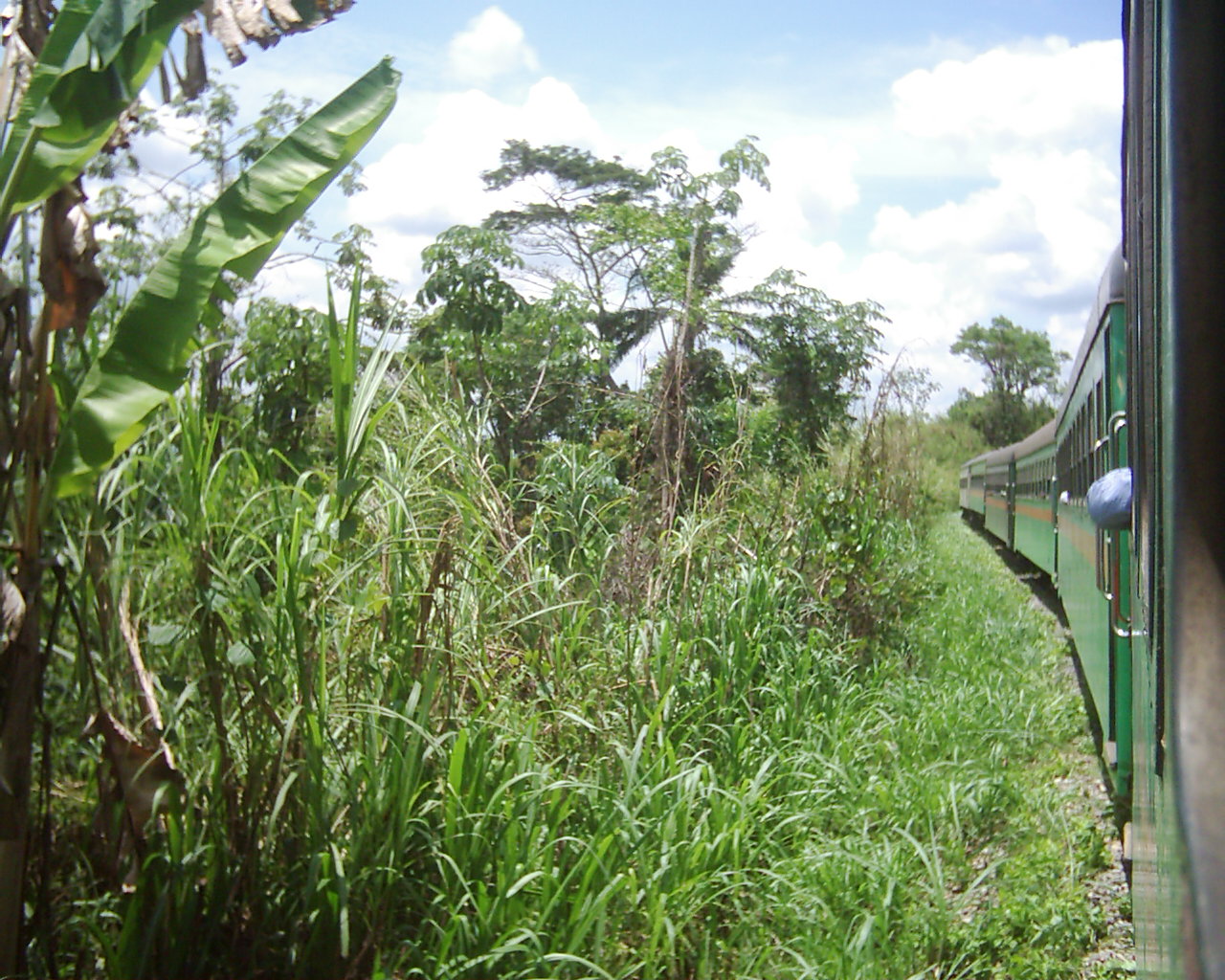
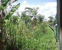 View from a rail car in 2003.
The Matadi-Kinshasa Railway is a railway line in Kongo Central Province between the port of Matadi and Kinshasa, the capital of Democratic Republic of the Congo.
The Matadi-Kinshasa Railway was built from 1890 to 1898. Its length is 366 kilometres and it is run by ONATRA.
Contents
History
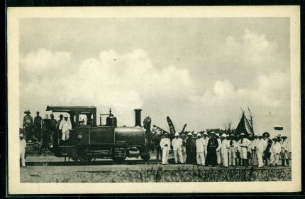
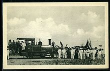 The first locomotive arriving at Léopoldville in 1898
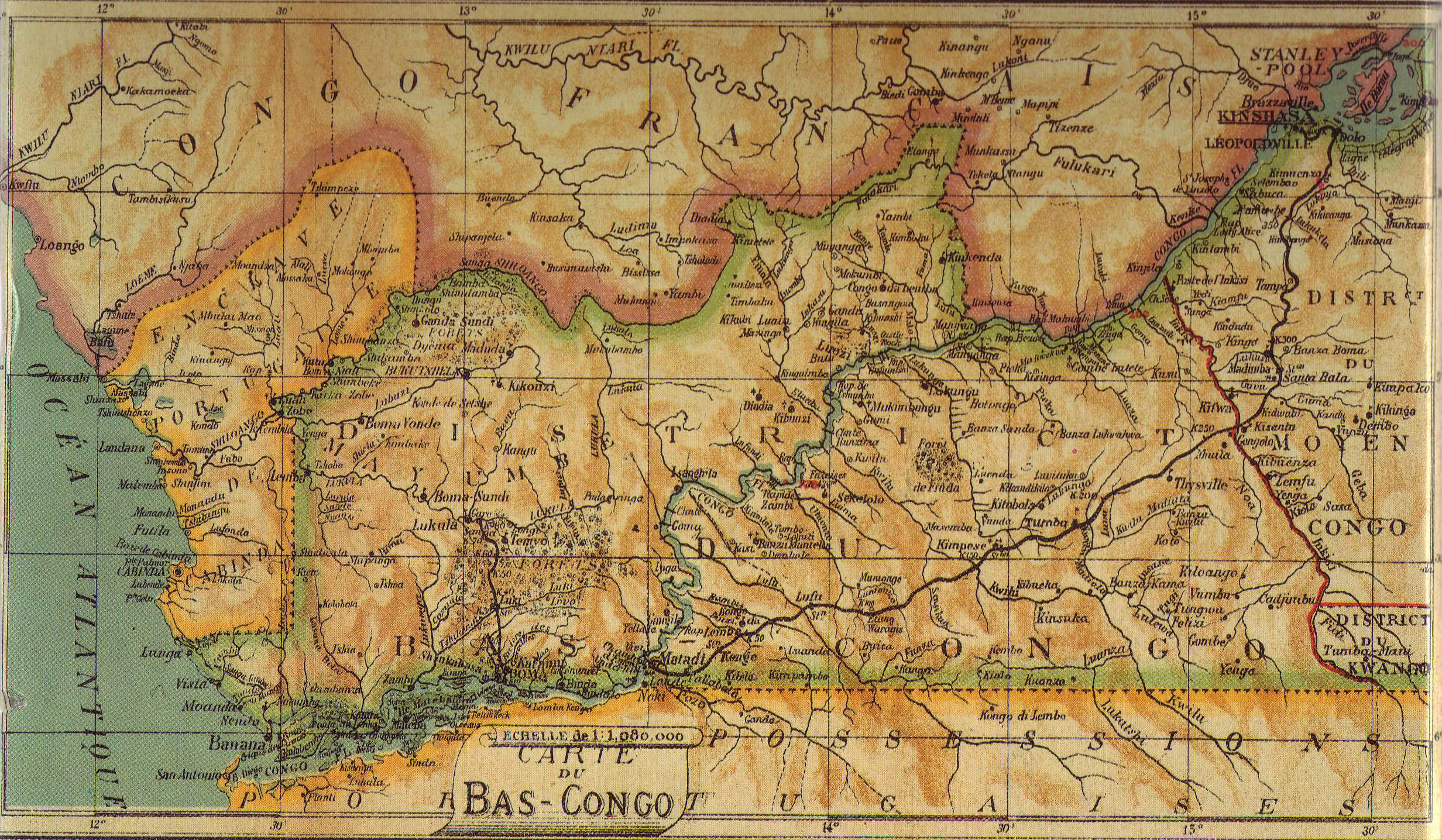
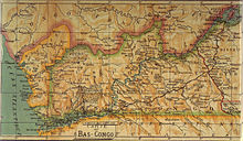 The line in 1913 (with also the first section of the Mayumbe Railway in the North)
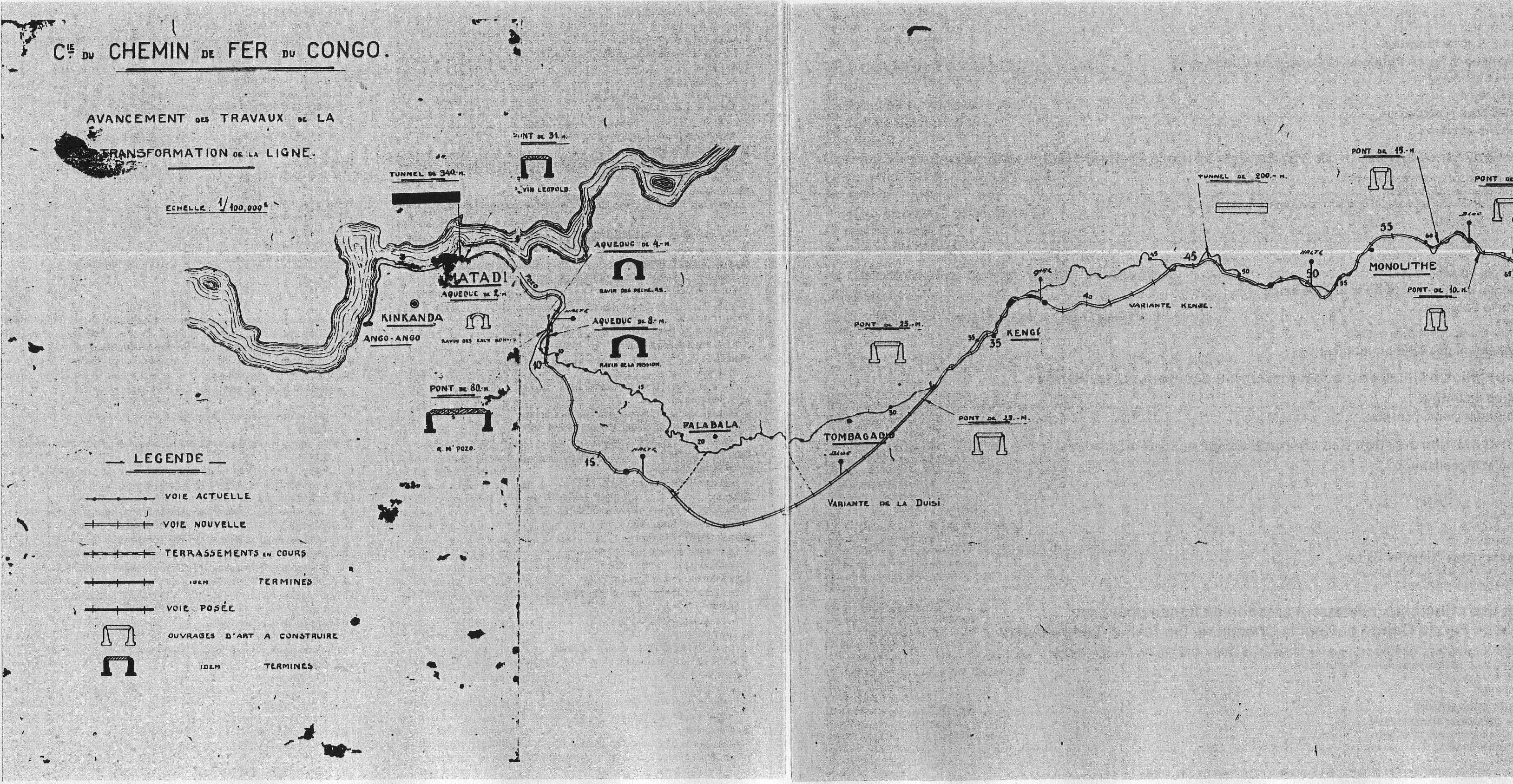
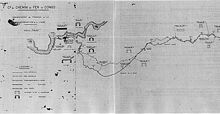 The new track as it could be seen on 25 July 1927 (engineer's map).
In the 1880s the exploration and exploitation of the Congo territory was carried out by the Congo Free State, which benefitted from hydrographic network of the Congo River. But between Matadi and Kinshasa (formerly known as Léopoldville), the river was not navigable, being barred by the Livingstone Falls, which follow one another for 300 kilometres. Transport was done by human bearers, which was not very efficient and often fatal. Therefore it was decided to build a railway line along this route.
The Compagnie du Congo pour le Commerce et l'Industrie (CCCI) was founded on 31 July 1887. On the same day the Compagnie du Chemin de Fer du Congo (CCFC) was created. Work on the railway was directed by Albert Thys, who would give his name to one of the stations, Thysville (now Mbanza-Ngungu). The completion of the railway cost the lives of 1,932 people (1,800 blacks and 132 whites).
The main difficulty was to make it possible for the railway line to leave the gorges of the Congo River, through the canyon the M'pozo River and a passage along the Monts de Cristal.
The hard labour on the railway line is mentioned by Joseph Conrad in his novel Heart of Darkness, which he witnessed when he worked in the Congo Free State.
Started in 1890, the railway line was completed in 1898. It was built to a nominal gauge of 750 mm (2 ft 5 1⁄2 in), and all rolling stock was constructed to this gauge. However as local labour had difficulty grasping the concept of gauge widening on curves, the entire line was built to a gauge of 763mm.[1] Alterations were made from 1923 to 1931, when it was converted to 3 ft 6 in (1,067 mm) gauge. Several tens of thousands of people, convicts and forced workers, were employed for this renovation. 7,000 people lost their lives here.
In spite of the technical and financial difficulties related to the construction of the railway line, the railway line very quickly proved to be profitable, mainly because of the transportation of ivory and rubber. As a 750 mm (2 ft 5 1⁄2 in) gauge railway it operated a large fleet of 0-6-0T, 0-6-2T, 2-6-2T locomotives before turning to 32 0-6-0+0-6-0 Garratts, and finally 5 - outside-framed 2-8-2 locomotives.
The railway can be classified as a portage railway.
Specifications
1898-1932 1932-present[2] Route Original Deviation Gauge 750 mm (2 ft 5 1⁄2 in) 1,067 mm (3 ft 6 in) Rails 21.5 kg/m (43.3 lb/yd) 33.4 kg/m (67.3 lb/yd) Axle load 10 t (11 short tons; 10 long tons) 15 t (17 short tons; 15 long tons) Length 249 mi (401 km) 227 mi (365 km)[3] Rise max. 45‰ (4.5%) 17‰ (1.7%) Radius min. 55 yd (50.3 m) 273 yd (249.6 m) Main stations
Main article: Railway stations in DRCongoMatadi–Kinshasa Railway Legend

365 Kinshasa East (307 m) 

to Kinshasa West 

N'Dolo 
Limete Amicongo 
Limete Limete UZAM (Kingabwa) 

to Ndjili Airport Matete Rifflart Kilembo 338 Kimwenza (330 m) Block 329 321 Kasangulu (400 m) Vindevoghel Bailleux Wolter 277 Sona Bata (531 m) 266 Madima (532 m) Nguvu 247 Kisantu–Inkisi (520 m) Block 236 

225 0 Marchal (580 m) 

16 Mbanza-Ngungu (Thysville) (741 m) 216 Kiasi-Pass (669 m) Kiasi 198 Dethieu (454 m) 194 Kolo (439 m) 187 Cattier (420 m) 176 Moerbeke (400 m) Tumba 154 Lukala (390 m) 143 Kimpese (333 m) Malanga Kwilu Block 110 Block 100 93 Songololo (320 m) Cipello 74 Lufu (315 m) Monolithe Fornasari 38 Kenge (265 m) Tombagadio Bousin 8 Mpozo (72 m) 

(270 m) 
0 Matadi (28 m) Petrocongo 
8 Ango-Ango - Matadi, ( 1m) ocean port up river
- Songololo (301m)
- Mbanza-Ngungu (604m) - terminus of short branch; workshops
- Kintoni (380m)
- Madimba (438m)
- Kasangulu (339m)
- Kinshasa, (177m) Railhead, river port and national capital.
Present day
The railway line and the port of Matadi are currently the main connection of Kinshasa with the external world. The renovation of the Road to Matadi, in beginning of the 2000s, however somewhat alleviated this situation.
The railway line is underexploited and dangerous.
Accident
On November 26, 2003, a train ran off the line and was damaged in the river, officially causing 10 dead. There remain currently eight locomotives in operating state.
See also
- Congo-Ocean Railway in the Republic of Congo.
- Congo Railway
- List of rail accidents (2000–present)
- Minimum railway curve radius
- Rail transport in the Democratic Republic of the Congo
References
- ^ Durrant, A.E., A.A. Jorgensen, C.P. Lewis. Steam in Africa, London, 1981, Hamlyn.
- ^ Blanchart Charles: Le Rail au Congo Belge (2 tomes). Bruxelles: Blanchart, 1993/1999.
- ^ 246 mi (396 km) including the branches to Ango-Ango and Mbanza-Ngungu (Thysville)
Categories:- Rail transport in the Democratic Republic of the Congo
- 760 mm gauge railways
- Kinshasa
- Matadi
- 3ft 6in gauge railways
Wikimedia Foundation. 2010.