- Moroto Town
-
"Moroto, Uganda" redirects here. For Moroto District, see Moroto District. For Mount Moroto, see Mount Moroto.
- Moroto is also the name of a county in Lira District, Uganda.
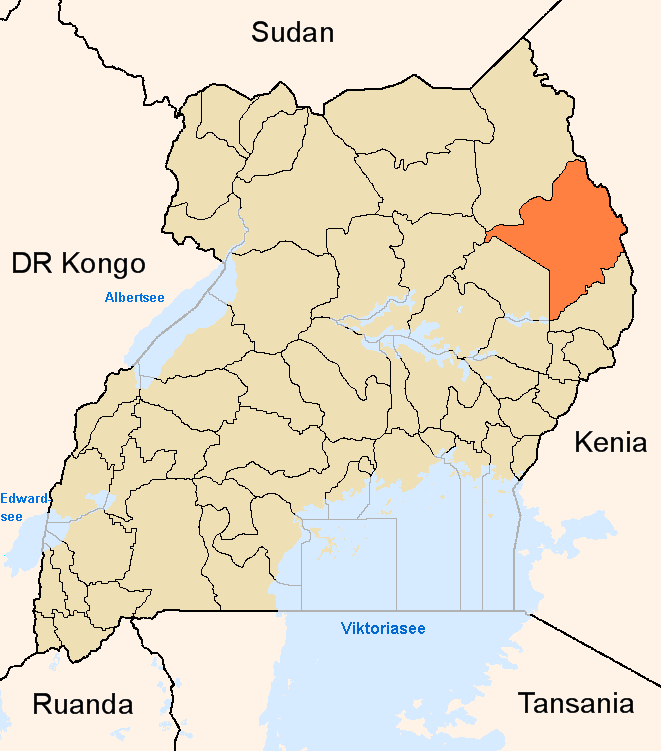
Moroto Location in Uganda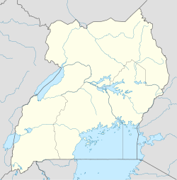
 Moroto
Coordinates: 02°31′48″N 34°40′12″E / 2.53°N 34.67°E Country  Uganda
Region Northern Uganda Sub-region Karamoja sub-region District Moroto District Government – Mayor Elevation 4,528 ft (1,380 m) Population (2011 Estimate) – Total 12,300 Moroto is a town in Northern Uganda, lying west of Mount Moroto. It is the 'chief town' of Moroto District and the district headquarters are located there. The district was named after the town.
Contents
Location
Moroto is located approximately 210 kilometres (130 mi), by road, northeast of Mbale, the nearest large city.[1] This location lies approximately 420 kilometres (260 mi), by road, northeast of Kampala, the capital of Uganda and the largest city in that country.[2] The coordinates of the town are:01 31 48N, 34 40 12E (Latitude:2.5300; Longitude:34.6700).
Population
The 2002 national census estimated the population of Moroto at 7,380. In 2008, the Uganda Bureau of Statistics (UBOS), estimates the population of the town at 10,300.[3] In 2011, UBOS estimated the mid-year population of Moroto at 12,300.[4]
Landmarks
The landmarks within the town limits or near the edges of town include:
- The headquarters of Moroto District Administration
- The offices of Moroto Town Council
- Mount Moroto - Rising to a peak of 3,000 metres (9,800 ft), above sea level, the mountain is only 3 kilometres (1.9 mi), east of the town.
- Moroto Central Market
- Moroto Airport - A public airport located about 8 kilometres (5.0 mi) west of town.
Other points of interest
Other points of interest in or near Moroto include:
- A branch of Stanbic Bank
- A branch of the National Social Security Fund
- Moroto Regional Referral Hospital - A 200 bed regional referral hospital administered by the Uganda Ministry of Health
- The headquarters of the Roman Catholic Diocese of Moroto
External links
See also
References
 Moroto DistrictCapital: Moroto
Counties and
sub-countiesBokora County · Matheniko County · Moroto Municipality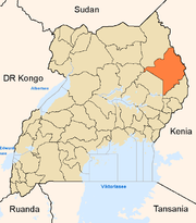
Towns and
villagesMorotoEconomy Stanbic BankNotable
landmarksMoroto Regional Referral Hospital · St. Kizito Matany Hospital · Mount Moroto · Moroto Airport · Roman Catholic Diocese of MorotoCategories:- Populated places in Uganda
- Moroto District
- Northern Region, Uganda

Wikimedia Foundation. 2010.