- Wondabyne railway station, New South Wales
Cityrail Station alt|station_name=Wondabyne|
servicearea=Newcastle & Central Coast Line|servicearea_color=#Newcastle line colour|servicearea_textcolor=white
code=WDB|town=Wondabyne|street=No road accesscite web
url = http://www.parliament.nsw.gov.au/prod/PARLMENT/hansArt.nsf/V3Key/LA19960501037
title = Pawnbrokers And Second-Hand Dealers Bill - Second Reading
author =Marie Andrews , MP
publisher =Parliament of New South Wales
date =1996-05-01
accessdate = 2007-08-09] |distance=65.15|altitude=0|traintype=Intercity|platforms=2|tracks=2|platform_arr=2 Side|stationtype=Ground|gates=No|connect=None|disabled=No
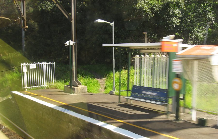
facilities= [http://www.cityrail.info/facilities/facilities.jsp?n=311&giveOutput=true&facility= Link]Wondabyne railway station is a railway station on the Newcastle and Central Coast Line in theCityRail network inNew South Wales ,Australia . The station is noted for its remoteness and having an extraordinarily short platform, which is less than a train carriage long.Fact|date=August 2007 It is the only railway station in Australia which has no road access.The station is an optional stop, and any passenger wishing to alight at the station must inform the guard of their intention to do so, and then travel in the last carriage of the train and exit through the rear door only.cite web
url = http://www.paddypallin.com.au/default.aspx?page=33&sc=24
title = Bushwalking around Sydney: Wondabyne to Pindar Cave
author = Jason Hughes
publisher = Paddy Pallin
accessdate = 2007-08-09] [cite web
url = http://www.sydneyclimbing.com/xgo_wondabyne_mainline.html
title = Wondabyne Mainline
author = Peter Monks
publisher = A Rockclimber's Guide to Sydney
accessdate = 2007-08-09] When a passenger wishes to board a train at Wondabyne, they must flag the driver. The platform on the Mullet Creek side connects to a public pontoon. Six kilometres southwards downstream, Mullet Creek flows into theHawkesbury River .Platforms/Service
Platform 1:
*Newcastle and Central Coast line colour>Newcastle & Central Coast Line - intercity services to Central (via Strathfield).Platform 2:
*Newcastle and Central Coast line colour>Newcastle & Central Coast Line - intercity services to Gosford and Wyong.Bushwalking tracks
At the south end of the platform on the escarpment side is a track that climbs to the edge of the plateau above. At the edge a well formed fire trail continues on to Mount Kariong and then the
Gosford suburb ofKariong . There is a bus service from Kariong to Gosford.Fifteen minutes along the trail from the edge of the escarpment, on the south side, a track commences that ends at the well known geological formation,
Pindar Cave . [cite web
url = http://ozultimate.com/bushwalking/walk.php?int_resource_id=221
title = Pindar Cave
author = Tom Brennan
publisher = Bushwalking NSW
accessdate = 2007-08-09]See also
*
Brisbane Water National Park
*Brooklyn, New South Wales References
External links
Wikimedia Foundation. 2010.