- Cimarron Canyon State Park
-
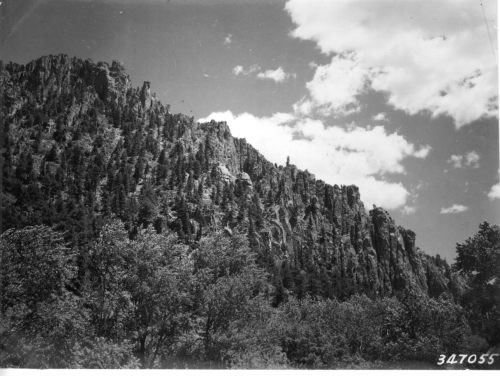
Cimarron Canyon State Park New Mexico State Park  The Palisades Sill in Cimarron Canyon
Country  United States
State  New Mexico
County Colfax Location Eagle Nest - elevation 7,500 ft (2,286 m) - coordinates 36°32′16″N 105°10′30″W / 36.53778°N 105.175°W Area 378 acres (153 ha) Founded 1979 Management New Mexico State Parks Division Owner New Mexico State Game Commission [1] 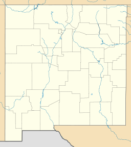
 Location of Cimarron Canyon State Park in New Mexico
Cimarron Canyon State Park is a state park of New Mexico, USA, located 3 miles (4.8 km) east of Eagle Nest in the Colin Neblett Wildlife Area. The park is popular for trout fishing in the Cimarron River and its tributaries, Clear Creek and Tolby Creek.[2]. The park also has numerous trails, which are used for hiking in the summer and snow shoeing in the winter. Cimarron Canyon State Park has 94 developed campsites, and four restrooom facilities. Throughout the year, you can expect to see Deer, Elk, Bear, Turkey, and many species of birds.
The park extends for 8 miles (13 km) along the Cimarron Canyon between Tolby Creek and Ute Park. The Palisades Sill forms spectacular cliffs above the Cimarron River here.
Gallery
-

Cimarron Canyon State Park, just below the dam for Eagle Nest Lake.
-

Deer at Cimarron Canyon State Park
References
- ^ "Cimarron Canyon State Park Management Plan 2010". New Mexico State Parks Division. http://www.emnrd.state.nm.us/prd/documents/CimarronPMPFinalPDFs_000.pdf. Retrieved 2011-03-03.
- ^ Cimarron Canyon State Park
External links
Categories:- New Mexico state parks
- Parks in Colfax County, New Mexico
- Protected areas established in 1979
-


Wikimedia Foundation. 2010.