- Church Leigh
-
Coordinates: 52°55′12″N 1°57′57″W / 52.919978°N 1.965834°W
Church Leigh 
The Village of Church Leigh
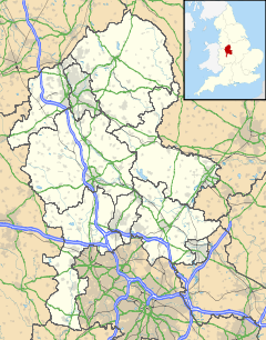
 Church Leigh shown within Staffordshire
Population 906 OS grid reference SK020350 - London 148 mi (238 km) Parish Leigh CP District East Staffordshire Shire county Staffordshire Region West Midlands Country England Sovereign state United Kingdom Post town STOKE-ON-TRENT Postcode district ST10 Dialling code 01889 Police Staffordshire Fire Staffordshire Ambulance West Midlands EU Parliament West Midlands UK Parliament Burton List of places: UK • England • Staffordshire Church Leigh is a village within the civil parish of Leigh in the English county of Staffordshire, England[1]. The village is 6.2 miles west north west of the town of Uttoxeter, 14.3 miles north east of Stafford and 148 miles north west of London. The village lies 0.8 miles south of the A50 that links Warrington to Leicester[2]. The nearest railway station is at Uttoxeter for the Crewe to Derby line. The nearest airport is East Midlands Airport.
History
Church Leigh has an entry in the Domesday Book of 1085[3]. In the great book Church Leigh (Only as Leigh) is recorded by the name Lege
References
- ^ OS Explorer Map 259, Derby, Ashbourne & Cheadle. ISBN 0-319-21895-3
- ^ A to Z East Midlands Road Map, ISBN 1-84348-283-5
- ^ The Domesday Book, Englands Heritage, Then and Now, Editor: Thomas Hinde, Shropshire, Leigh, page 248, ISBN 1858334403
External links
 Media related to Church Leigh at Wikimedia CommonsCategories:
- East Staffordshire
- Villages in Staffordshire
- Staffordshire geography stubs
Wikimedia Foundation. 2010.

