- Clapham railway station, Adelaide
-
 Clapham
Railways in Adelaide - List of Railway Stations 
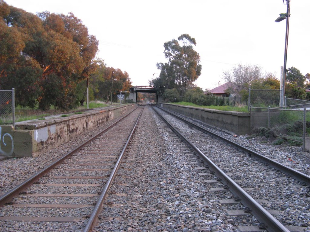
Train Services Location Street Springbank Road Suburb Clapham Distance from Adelaide 10.0 km Access by Station closed Frequency Hi-Frequency Station unknown Peak Frequency unknown Weekday Frequency unknown Weekend Frequency unknown Night Frequency unknown Facilities Real Rail Time Display unknown Real Rail Time Speaker unknown Number of Platforms 2 (neither in use) Platform Layout 2 side platforms Toilets unknown Car Parking unknown Bike Storage unknown Lounge unknown Kiosk unknown Wheelchair access 
unknown Other facilities unknown History Opened 1910s Rebuilt unknown Closed 1995 Adjacent Stations « Previous
Torrens ParkNext »
LyntonClapham railway station was a railway station on the Belair railway line in suburban Adelaide, South Australia, which was closed in April 1995. Its remains are located on the north side of the Springbank Road overpass in the inner southern Adelaide suburb of Clapham. It was located 10.0 km by railway from the Adelaide Railway Station. The station consisted of two earth-filled concrete faced platforms, with a small shelter (the seats are gone though) and disused speaker on the down track. The platform on the 'up' track may be on the ARTC's 'Hit list' of disused platforms to be removed.[citation needed]. During the Belair line renewal in 2009, the top edge of the 'down' platform was removed because of the risk of trains connecting and causing damage.
On all Adelaide Metro rail network maps (in most carriages), you can still see the gaps on the Belair line map where this, and other closed stations on the Belair railway line, have been removed.
Clapham had an interesting history. The suburb was presumably named after the Clapham area of South London. The station was originally the terminus of the Clapham branch line, which began at Mitcham station, and the original station was to the west of the more recent platforms (which were on the main line); this explains the unusual layout of the intersection of the local roads west of the Springbank Road overpass (opened 1924). At that time, Belair Rd, known as Bull's Creek Road, ran on the west side of the railway line from Wattlebury Road to McPherson Street. (The then main road to Belair, now called the Old Belair Road, was via Blythwood Road). The Clapham branch line, and the old station, were abandoned formally in 1917. Presumably, the newer station was built a little before that.
The Clapham passenger service, typically a P class locomotive and a couple of passenger cars, was known as the 'Clapham Dodger': this service must have ceased when the branch line was closed.
See also
- Clapham branch line
- Old Clapham railway station
References
- Callaghan WH. The overland railway. ARHS NSW, St James. 1992.
- Eardley, G. "The P class locomotives of South Australia." ARHS bulletin 416, June, 1972.
- Jennings R. Line clear: 100 years of train working Adelaide-Serviceton. Mile End Railway Museum, Roseworthy. 1986.
(Coordinates: 34°59′22″S 138°36′32″E / 34.9895°S 138.609°E
Belair railway line Adelaide - Mile End - Mile End Goods (demolished) - Keswick - Goodwood - Millswood (disused) - Unley Park - Hawthorn (disused) - Mitcham - Torrens Park - Clapham (disused) - Lynton - Sleeps Hill (removed) - Eden Hills - Coromandel - Blackwood - Glenalta - Pinera - BelairCategories:- Disused railway stations in South Australia
- Railway stations closed in 1995
Wikimedia Foundation. 2010.