Nahanni Range Road

Nahanni Range Road
Nahanni Range Road heading eastwards
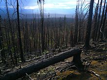
Taiga near Nahanni Range Road
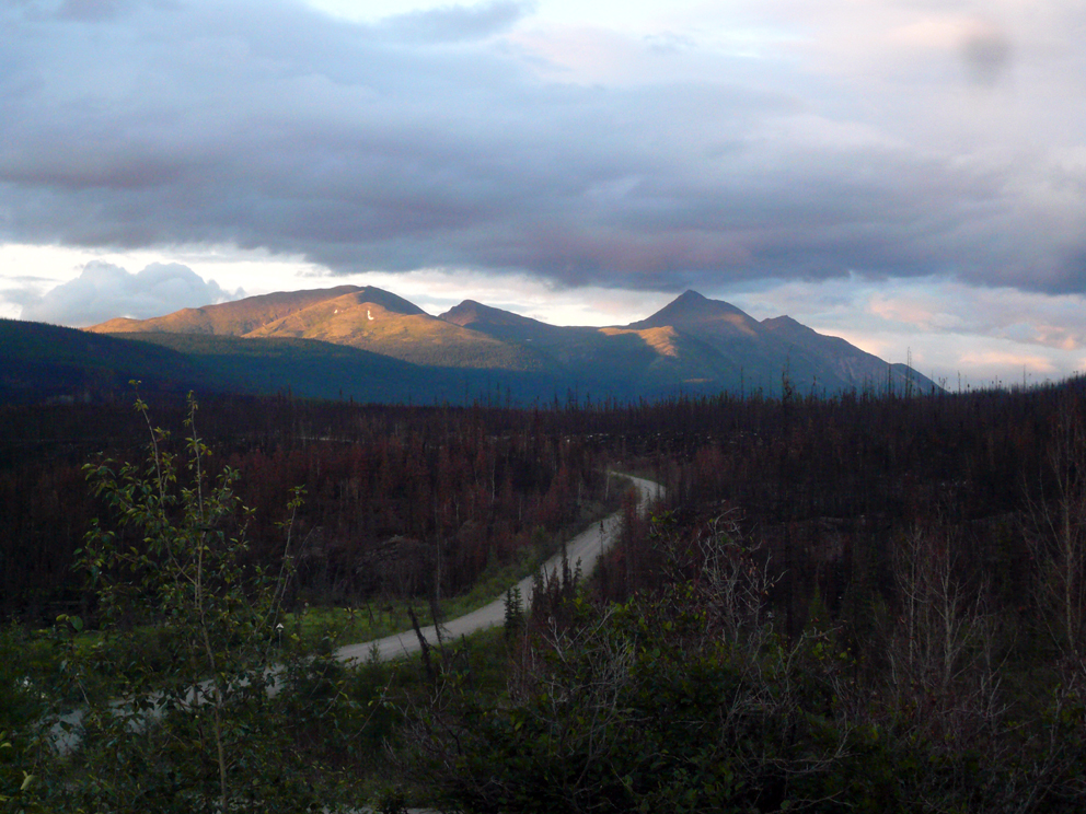
Yukon Highway 10
Northwest Territories, no official route number (maintained by mining company)

The Nahanni Range Road was completed in the early 1960s from Watson Lake, Yukon along the present alignment of the Robert Campbell Highway to Cantung Junction, thence along the Highway 10 route, across the border into the Northwest Territories to the privately-owned mining town known, confusingly, as either Cantung (for Canada Tungsten Mining Corporation) or Tungsten (for the mineral mined there). The portion between Cantung Junction and Watson Lake has, since 1971, been part of the Robert Campbell Highway (Yukon Highway 4).

The Nahanni Range Road proper is entirely gravel, and is not recommended for general public use. Originally, two-thirds of the route was maintained by the Yukon government, and had campgrounds for public use. The remaining third was maintained by the mining company, open to public traffic, but with no public facilities at the town. When the mine shut in 1986, the road fell into disuse and maintenance became increasingly difficult. Since the mine resumed intermittent production in 2003, the road has been restored for the use of the mining company, but general public travel is still not advised.


Wikimedia Foundation. 2010.

Игры ⚽ Нужно сделать НИР?

Look at other dictionaries:

  • Nahanni Range Road — Nahanni Range Road, appelée aussi Yukon Highway 10, est une route du Yukon au Canada. Elle commence à 110 kilomètres (68 mi) de Watson Lake, au lieu dit Cantung Junction (appelé aussi Miner s Junction), sur la Robert Campbell… …   Wikipédia en Français

  • Nahanni National Park Reserve — IUCN Category II (National Park) Virginia Falls …   Wikipedia

  • Mackenzie Mountains — Geobox|Range name=Mackenzie Mountains image caption=Keele Peak, 2005 country=Canada region=Yukon| region1=Northwest Territories | region type=Territories parent= border= length imperial=| length round= 1| length orientation= width imperial =|… …   Wikipedia

  • Mackenzie Mountains — p1 Mackenzie Mountains Der Keele Peak in den Mackenzie Mountains Höchster Gipfel Keele Peak (2.972 m …   Deutsch Wikipedia

  • Наханни-Рендж (трасса) — Дорога Наханни Рейндж Nahanni Range Road …   Википедия

  • Roads to Resources Program — The Roads to Resources Program was initiated by the Progressive Conservative government of Prime Minister of Canada John Diefenbaker from 1957 to 1963.The program was intended to complete transportation infrastructure in remote areas of Canada to …   Wikipedia

  • Robert Campbell Highway — Yukon Highway 4The Robert Campbell Highway or Campbell Highway is a road between Watson Lake, Yukon on the Alaska Highway to Carmacks, Yukon on the Klondike Highway. It is 583 kilometres long and mostly gravel surfaced. It serves the communities… …   Wikipedia

  • Список основных автодорог Юкона — Автодороги канадской территории Юкон находятся в ведении департамента дорог и общественных работ правительства Юкона. Всего в Юконе более 150 автодорог, из них 14 являются основными территориальными дорогами и имеют номер меньше 100. Ниже… …   Википедия

  • Liste des routes du Yukon — Numéro Depuis Jusqu à Longueur Route de l Alaska Alaska 2 Yukon 1 Colombie Britannique 97 Dawson Creek Colombie Britannique Fairbanks Alaska 2 451 kilomètres (1 523 mi) Klondike Highway …   Wikipédia en Français

  • Yukon Highway 4 — Der Robert Campbell Highway (Yukon Highway 4) ist eine größtenteils geschotterte Straße im Yukon in Kanada. Sie ist 582 km lang und führt von Watson Lake am Alaska Highway im Südosten des Yukon Richtung Nordwesten nach Carmacks am Klondike… …   Deutsch Wikipedia

Share the article and excerpts

Direct link
Do a right-click on the link above
and select “Copy Link”