- Nərimankənd, Gobustan
-
Nərimankənd — Municipality — 
 Nərimankənd
Coordinates: 40°31′04″N 48°56′38″E / 40.51778°N 48.94389°ECoordinates: 40°31′04″N 48°56′38″E / 40.51778°N 48.94389°E Country  Azerbaijan
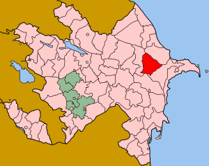
Rayon Gobustan Population[citation needed] – Total 3,358 Time zone AZT (UTC+4) – Summer (DST) AZT (UTC+5) Nərimankənd (also, Narimankend) is a village and municipality in the Gobustan Rayon of Azerbaijan. It has a population of 3,358.
References
Bədəlli · Bəklə · Çay Qurbançı · Çelov · Cəmcəmli · Cəngi · Cəyirli · Ceyrankeçməz · Çuxanlı · Dağ Kolanlı · Damlamaca · Dərəkənd · Ərəbqədim · Ərəbşahverdi · Ərəbşalbaş · Goydərə · Gyurgyur · Həmyəli · Ilanlı · Nabur · Nardaran · Nərimankənd · Poladlı · Qarabulaq · Qaracüzlü · Qurbançı · Sədəfli · Şixandağ · Şıxlar · Şıxzahırlı · Şorsulu · Sündü · Təklə Mirzəbaba · Təklə · Təsi · Üzümçü · Xilmilli · Yekəxana
 Categories:
- Populated places in Gobustan Rayon
- Daglig-Shirvan Economic Region geography stubs

Wikimedia Foundation. 2010.