- Aşağı Surra
-
Aşağı Surra — Municipality — 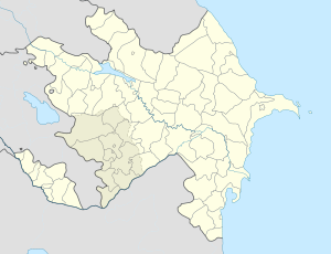
 Aşağı Surra
Coordinates: 39°29′06″N 49°00′34″E / 39.485°N 49.00944°ECoordinates: 39°29′06″N 49°00′34″E / 39.485°N 49.00944°E Country  Azerbaijan
Rayon Neftchala Population[citation needed] – Total 4,338 Time zone AZT (UTC+4) – Summer (DST) AZT (UTC+5) Aşağı Surra (also, Ashaga-Sura and Ashagy Surra) is a village and municipality in the Neftchala Rayon of Azerbaijan. It has a population of 4,338.
References
Towns 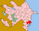
Villages Abasallı, Astanlı, Aşağı Qaramanlı, Aşağı Surra, Bala Surra, Balıcallı, Beştalı, Birinci Mayak, Birinci Qaralı, Boyat, Cəngan, Dalğalı, Dördlər, Dördlər, Ərəbqardaşbəyli, Haqverdilər, İkinci Mayak, İkinci Qaralı, Kür Qarabucaq, Kürdili, Kürkənd, Mikayıllı, Mirzəqurbanlı, Mürsəqulu, Pirəbbə, Qaçaqkənd, Qaraqaşlı, Qazaxbərəsi, Qədimkənd, Qırmızı Şəfəq, Qırmızıkənd, Qızqayıtdı, Ramazanlı, Sahiloba, Sarıqamış, Seyidlər, Şirvanlı, Şorkənd, Sübh, Tatarməhlə, Uzunbabalı, Xanməmmədli, Xəzər, Xol Qarabucaq, Xol Qaraqaşlı, Xoltəzəkənd, Yenikənd, Yeniqışlaq, Yuxarı QaramanlıOld or renamed places Babakhanly · Bëyuk-Oriyat · Chapayevka · Gadzhi-Mayly · Ismilli · İyirmi Altı Bakı Komissarı · Karaakhmedli · Karavelli · Meshadilyar · Meshdally · Nord-Ost-Kultuk · Promysel Narimanova · Prorva · Novovasilyevka · Tamozhnya · Ustye KuryCategories:- Populated places in Neftchala Rayon
- Neftchala Rayon geography stubs


Wikimedia Foundation. 2010.