- Fort St. John Airport
-
Fort St. John Airport
North Peace AirportIATA: YXJ – ICAO: CYXJ
– WMO: 71943Summary Airport type Public Operator North Peace Airport Services Ltd. Location Fort St. John, British Columbia Elevation AMSL 2,280 ft / 695 m Coordinates 56°14′18″N 120°44′25″W / 56.23833°N 120.74028°WCoordinates: 56°14′18″N 120°44′25″W / 56.23833°N 120.74028°W Website Map Location in British Columbia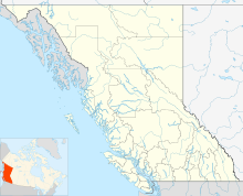
 CYXJ
CYXJRunways Direction Length Surface ft m 02/20 6,698 2,042 Asphalt 11/29 6,909 2,106 Asphalt Statistics (2010) Aircraft movements 28,939 Sources: Canada Flight Supplement[1]
Environment Canada[2]
Movements from Statistics Canada[3]Fort St. John Airport (IATA: YXJ, ICAO: CYXJ), North Peace Regional Airport, or North Peace Airport, is located at Fort St. John, British Columbia, Canada. The airport is operated by North Peace Airport Services Ltd (a subsidiary of Vancouver International Airport Authority).
Contents
Runways
Fort St. John Airport currently has two runways. Runway 11/29 is a 6,909 by 150 ft (2,106 by 46 m) paved runway, while runway 02/20 is a 6,698 by 200 ft (2,042 by 61 m) paved runway.
Operators
Airlines Destinations Air Canada Express operated by Jazz Air Vancouver Central Mountain Air Dawson Creek, Edmonton, Fort Nelson, Prince George Swanberg Air[4] Grande Prairie, Fort Nelson Trek Aerial Surveys[5] Northern BC/AB, NWT, YT Quest Helicopters[6] Fort Nelson Bailey Helicopters[7] Northern BC See also
References
 This article incorporates public domain material from websites or documents of the Air Force Historical Research Agency.
- ^ Canada Flight Supplement. Effective 0901Z 20 October 2011 to 0901Z 15 December 2011
- ^ Synoptic/Metstat Station Information
- ^ Total aircraft movements by class of operation — NAV CANADA flight service stations
- ^ http://www.swanbergair.com/
- ^ http://www.trekair.ca/
- ^ http://www.qwesthelicopters.com/
- ^ http://www.baileyhelicopters.com/
External links
- Fort St. John Airport
- Vancouver Airport Services (YVRAS)
- COPA Page about this airport on COPA's Places to Fly airport directory
- Past three hours METARs, SPECI and current TAFs for Fort St. John Airport from NAV CANADA as available.
Airports in Canada By name A–B · C–D · E–G · H–K · L–M · N–Q · R–S · T–ZBy location indicator CA · CB · CC · CD · CE · CF · CG · CH · CI · CJ · CK · CL · CM · CN · CO · CP · CR · CS · CT · CV · CW · CY · CZBy province/territory National Airports System Calgary · Charlottetown · Edmonton · Fredericton · Gander · Halifax · Iqaluit · Kelowna · London · Moncton · Montréal-Mirabel · Montréal-Trudeau · Ottawa · Prince George · Québec · Regina · Saint John · St. John's · Saskatoon · Thunder Bay · Toronto · Vancouver · Victoria · Whitehorse · Winnipeg · YellowknifeRelated List of airports by ICAO code: C · List of defunct airports in Canada · List of heliports in Canada · List of international airports in Canada · National Airports System · Operation Yellow RibbonCategories:- Airfields of the United States Army Air Forces in Canada
- Airports in British Columbia
- Fort St. John, British Columbia
- Peace River Regional District
- USAAF Air Transport Command Airfields - Alaska
- British Columbia airport stubs

Wikimedia Foundation. 2010.