- Okakarara
-
Okakarara — Town — Location in Namibia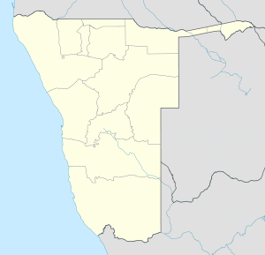
 Okakarara
Coordinates: 20°35′9″S 17°27′28″E / 20.58583°S 17.45778°ECoordinates: 20°35′9″S 17°27′28″E / 20.58583°S 17.45778°E Country  Namibia
Region Otjozondjupa Region Constituencies of Namibia Okakarara Constituency Government - Mayor Ehrnst Katjiku Population (2009) - Urban 7,000 Time zone South African Standard Time (UTC+1) Okakarara is a town in Otjozondjupa Region, Namibia, located 50km southeast of Waterberg National Park.[1] It has an estimated population of 7000 and is currently growing by 1500 inhabitants annually.[2]
Okakarara consists of the residential areas of Opamue, the former whites-only area, and Okakarara Proper, the former black residential area. It is the district capital of the Okakarara electoral constituency that includes surrounding settlements.
Formerly part of the Apartheid-era bantustan Hereroland, the area is still mainly populated by the Herero people. Because of this, Okakarara is one of the few towns in Namibia where the otherwise dominant SWAPO party came only second in the 2004 elections, and the Herero-dominated NUDO won. Due to a very unusual coalition between SWAPO and DTA, the elected town mayor Ehrnst Katjiku has SWAPO affiliation.
Contents
History
The first house was built by Salathiel Kambamba Kambazembi and Reinard Tjerie who arrived in the area in 1923. The settlement grew over time and was proclaimed a town in 1992.[2]
Economy
Since 2007, Okakarara houses an annual trade fair. This initiative also led to the erection of a trade centre and an SME park.[2] The town further features a secondary school,a government hospital, a vocational training centre, and an abbatoir.
Okakarara Trade Fair
The Okakarara trade fair is an annual four-day trade fair event which was first started in 2007 as a way to bring the breeders of the communal area around the town together to showcase the animals and as well as share ideas on how they can help improve farming methods. Marquees are erected at the Okakarara Community Cultural Centre which was built with funding from Germany, to accommodate the increased number of exhibitors, as the existing hall is too small to cater to all the exhibitors. Exhibitiors include automobiles dealers showcase their latest models. Farmers showcasing their livestock, food stalls beverages and many other stalls available. Other exhibitors engaged in the selling of agricultural equipment and vehicles are placed around the fairground on open stands,. Because Okakarara is in a rural area, agriculture is important and so the trade fair is a great opportunity to attract investment to the town and it also allows communal farmers to showcase their breeds.
Twin towns
Okakarara has twinning agreements with the following Namibian towns:[2]
Notable residents
- Esau Tjiuoro, a footballer in the Namibia Premier League and Namibia national football team
References
Categories:- Namibia geography stubs
- Otjozondjupa Region
- Towns in Namibia

Wikimedia Foundation. 2010.