- Osterode (district)
-
Osterode — District — 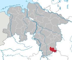
Country  Germany
State Lower Saxony Capital Osterode Area - Total 636 km2 (245.6 sq mi) Population (31 December 2010)[1] - Total 77,328 - Density 121.6/km2 (314.9/sq mi) Time zone CET (UTC+1) - Summer (DST) CEST (UTC+2) Vehicle registration OHA Website landkreis-osterode.de Osterode (German pronunciation: [ɔstəˈʁoːdə]) is a district in Lower Saxony, Germany. It is bounded by (from the southwest and clockwise) the districts of Göttingen, Northeim and Goslar, and by the state of Thuringia (districts of Nordhausen and Eichsfeld).
Contents
History
This part of the Harz mountains was ruled by the Welfen dynasty from the 12th century on. Osterode was the centre of the Principality of Brunswick-Grubenhagen, one of many small states within Brunswick-Lüneburg. Later this principality became part of Hanover, which in turn fell to the Kingdom of Prussia in 1866. In 1885 the Prussian administration established districts, among them Osterode.
Geography
More than two thirds of the district's area are occupied by the southwestern part of the Harz mountains, including the southern portion of the Harz National Park.
Coat of arms
The coat of arms displays two heraldic lions. The lion in the upper part is from the arms of Hanover, the lower lion represents the Welfen dynasty.
Towns and municipalities
Towns Samtgemeinden - 3. Walkenried
1seat of the Samtgemeinde; 2town See also
- Metropolitan region Hannover-Braunschweig-Göttingen-Wolfsburg
References
- ^ "Bevölkerungsfortschreibung" (in German). Landesbetrieb für Statistik und Kommunikationstechnologie Niedersachsen. 31 December 2009. http://www1.nls.niedersachsen.de/statistik/html/parametereingabe.asp?DT=K1000014&CM=Bev%F6lkerungsfortschreibung.
External links
 Media related to Landkreis Osterode am Harz at Wikimedia Commons
- Official website (German)
- Local history
 Urban and rural districts in the state of Lower Saxony in Germany
Region HanoverUrban districts Rural districts Ammerland · Aurich · Bentheim · Celle · Cloppenburg · Cuxhaven · Diepholz · Emsland · Friesland · Gifhorn · Goslar · Göttingen · Hamelin-Pyrmont · Harburg · Heidekreis · Helmstedt · Hildesheim · Holzminden · Leer · Lüchow-Dannenberg · Lüneburg · Nienburg · Northeim · Oldenburg · Osnabrück · Osterholz · Osterode · Peine · Rotenburg · Schaumburg · Stade · Uelzen · Vechta · Verden · Wesermarsch · Wittmund · WolfenbüttelCategories:- Districts of Lower Saxony

Wikimedia Foundation. 2010.