- Periyar River
Infobox River | river_name = Periyar
 |thumb|100px
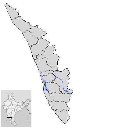
caption = Location map of the Periyar
origin = Sivagiri Hills on Western Ghats
mouth =Arabian Sea
basin_countries =India
length = 300 km (244 km in Kerala)
elevation = 1830 m
discharge = m³/s
watershed = 5396 km² (5284 km² in Kerala)The Periyar River is the longest river in the state ofKerala ,India , with a length of 244 km.The river is also known as "The lifeline of Kerala" as it is one of the few perennial rivers of Kerala. It provides drinking water for major towns.cite web
url=http://idukki.nic.in/dam-hist.htm
title=Idukki District Hydroelectric projects
publisher=
accessdate=2007-03-12]The
Idukki Dam has been built across the river and generates a significant proportion of electrical power for the state. This is a concrete, double curvature parabolic, thin arc dam. [cite web
url=http://expert-eyes.org/deepak/idukki.html
title=Salient Features - Dam
publisher=
accessdate=2007-03-12]Origin and Path
The Periyar's source is in the
Western Ghats range in theKerala state. Periyar is one of the few major rivers in Kerala which flow completely within the state. It flows north throughPeriyar National Park into Periyar Lake, an artificial reservoir created in1895 by the construction of a dam across the river. The lake has an area of 55 km². Water is diverted from the lake into theVaigai River ofTamil Nadu via a tunnel through theWestern Ghats .From the lake, the river flows northwest through the village of
Neeleswaram intoVembanad Lake and out to theArabian Sea coast. Its largest tributaries are theMuthirapuzha River ,Mullayar River ,Cheruthoni River ,Perinjankutti River and theEdamala River .The Periyar is the major water resource for five drought prone districts of Tamil Nadu, including Theni, Madurai and Ramanathapuram. The dam is maintained by Tamil Nadu PWD (public works department) and it is leased by the Tamil Nadu government for 999 years according to a pact between the governments of Kerala and Tamil Nadu. This deal was made during the British raj, between Travancore kingdom and the British colonial rulers representing Tamil Nadu
The Idduki Dam
The generators at the
Idukki Dam have a power output of 210 MW, and can generatepumped-storage hydroelectricity . In the daytime, the output from the dam is utilitized to the full. At night, when consumer demands are less than half of daytime use, spare capacity is used to pump water upstream to the dam. On the following day, the stored energy is then available to produce electricity to meet peak demand.Pollution
In the later parts of its journey to the Arabian Sea, the Periyar becomes heavily polluted. Various industries in the
Eloor industrial zone discharge their waste into it. Greenpeace India suggests that in this region the river has been turned into "a cesspool of toxins, which have alarming levels of deadly poisons like DDT, endosulfan, hexa and trivalent chromium, lead, cyanide, BHC." [ [http://www.greenpeace.org/india/campaigns/toxics-free-future/toxic-hotspots/eloor-kerala/history-and-chronology History and Chronology ] ]ee also
*
Idukki Dam
*Vaigai Dam Notes
References
*Stephen James "Periyar - The silent witness to History"
External links
* [http://www.hinduonnet.com/folio/fo0107/01070460.htm Periyar: A confluence of cultures]
* [http://www.peermade.info A lot on Kerala Hillstations]
Wikimedia Foundation. 2010.