- Lunenburg County, Nova Scotia
Infobox Settlement
official_name = Lunenburg County, Nova Scotia
other_name =
native_name =
nickname =
settlement_type = County
motto =
imagesize =
image_caption =
flag_size =
image_
seal_size =
image_shield =
shield_size =
city_logo =
citylogo_size =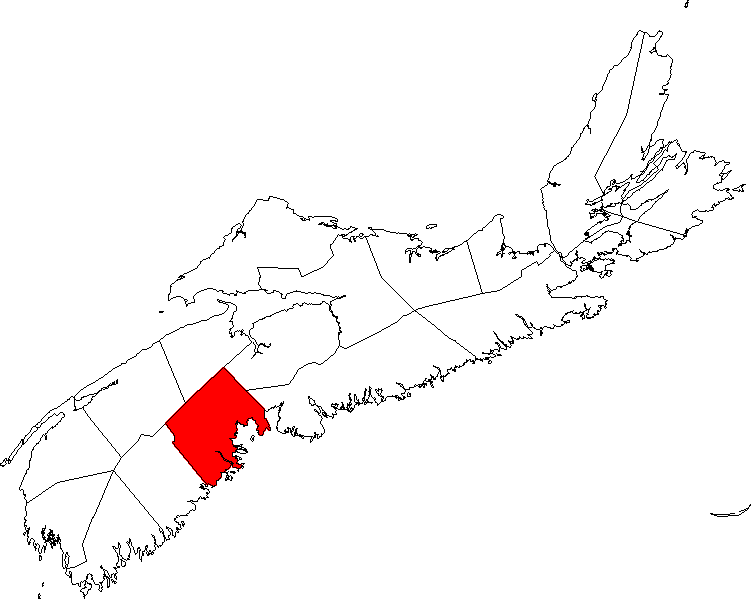
mapsize = 250px
map_caption = Location of Lunenburg County, Nova Scotia
mapsize1 =
map_caption1 =
image_dot_
dot_mapsize = 250px
dot_map_caption =Location of Pagename
dot_x = |dot_y =
pushpin_
pushpin_label_position =
pushpin_map_caption =
pushpin_mapsize =
subdivision_type = Country
subdivision_name = CAN
subdivision_type1 = Province
subdivision_name1 = NS
subdivision_type2 = Towns
subdivision_name2 = Bridgewater Lunenburg Mahone Bay
subdivision_type3 = Municipal Districts
subdivision_name3 = Chester Lunenburg
subdivision_type4 =
subdivision_name4 =
government_footnotes =
government_type =
leader_title =
leader_name =
leader_title1 =
leader_name1 =
leader_title2 =
leader_name2 =
leader_title3 =
leader_name3 =
leader_title4 =
leader_name4 =
established_title = Established
established_date = 1759
established_title2 =
established_date2 =
established_title3 =
established_date3 =
area_magnitude =
unit_pref =
area_footnotes =
area_total_km2 = 2907.95
area_land_km2 =
area_water_km2 =
area_total_sq_mi =
area_land_sq_mi =
area_water_sq_mi =
area_water_percent =
area_urban_km2 =
area_urban_sq_mi =
area_metro_km2 =
area_metro_sq_mi =
population_as_of = 2001
population_footnotes =
population_note =
population_total = 47,591
population_density_km2 = 16.4
population_density_sq_mi =
population_metro =
population_density_metro_km2 =
population_density_metro_sq_mi =
population_urban =
population_density_urban_km2 =
population_density_urban_sq_mi =
population_blank1_title =
population_blank1 =
population_density_blank1_km2 =
population_density_blank1_sq_mi =
timezone = AST
utc_offset = -4
timezone_DST =
utc_offset_DST =
latd= |latm= |lats= |latNS=N
longd= |longm= |longs= |longEW=W
elevation_footnotes =
elevation_m =
elevation_ft =
postal_code_type = Postal code
postal_code = B
area_code = 902
blank_name =Telephone Exchange
blank_info =
blank1_name =Median Earnings*
blank1_info =$37,335
website =
footnotes = *Median household income, 2000 ($) (all households)Part of a series about Places in Nova Scotia Lunenburg County is a
county located on the South Shore of the Canadian province ofNova Scotia , It ranges from Hubbards to the east andVogler's Cove to the west.Named in honor of the monarch, who was then also Duke of
Brunswick-Lüneburg , Lunenburg County was established in 1759, when peninsular Nova Scotia was divided into five counties. Three years later Lunenburg County was reduced in size when Queens County was established. Following the establishment of Queens County in 1762, Hants County in 1781, and Shelburne and Sydney Counties in 1784, the boundaries of all nine of the counties were defined by the Council of Nova Scotia.By Chapter 52 of the Statutes of 1863 the Municipality of Chester in the County of Lunenburg was made a separate District for certain specified purposes. That Statute provided authority for the appointment of a
Custos Rotulorum and for the establishment of a general sessions of the peace for the District of Chester, with the same powers as if it were a separate county.Lunenburg County includes the towns of Bridgewater, Lunenburg and Mahone Bay.
Lunenburg County includes the Municipal Districts of Chester and Lunenburg.
Lunenburg County includes many rural communities which contribute to and use the services of the towns such as LaHave, Newcombville, and Waterloo, to name a few.
Indian reserves in Lunenburg include Gold River, New Ross and Pennal.
Communities
For a list of communities in Lunenburg County, see List of communities.
External links
* [http://ns1763.ca/lunenco/lunencondx.html Photographs of historic monuments in Lunenburg County]
*Aspotogan Peninsula
* [http://www.gov.ns.ca/snsmr/muns/info/mapping/LUNEJ.asp Lunenburg County Map]
Wikimedia Foundation. 2010.