- Mahood Lake
-
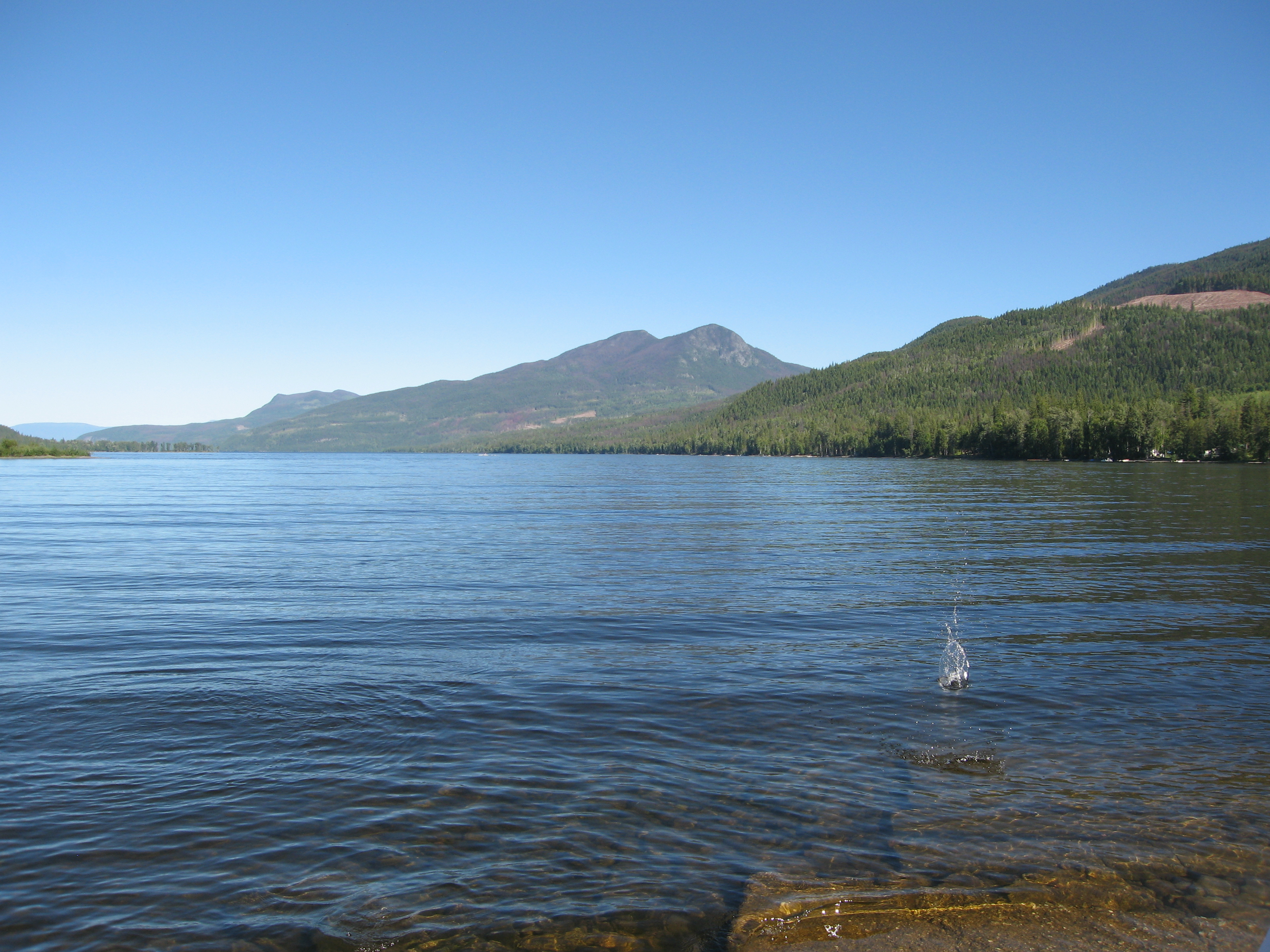
Mahood Lake 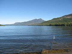
Location South Cariboo, British Columbia Coordinates 51°55′00″N 120°24′00″W / 51.9166667°N 120.4°WCoordinates: 51°55′00″N 120°24′00″W / 51.9166667°N 120.4°W Primary inflows Canim River, Deception Creek Primary outflows Mahood River Basin countries Canada Max. length 21 km (13.0 mi) Max. width 2.2 km (1.4 mi) Surface area 33.5 km² Surface elevation 629 m Islands 0 Mahood Lake is a lake in the South Cariboo region of the Interior of British Columbia in Wells Gray Provincial Park.[1] It is drained by the Mahood River, a tributary of the Clearwater River which has cut a deep canyon into Cambrian rocks and Pleistocene glacial moraines. Mahood Lake is fed by the short Canim River, which drains nearby Canim Lake to the west via Canim Falls and Mahood Falls.[2]
The lake is 629 metres in elevation, approximately 33.5 km² in area, 21 km (13.0 mi) in length (east to west) and a maximum of 2.2 km (1.4 mi) in width. Mount Mahood is immediately south of the lake and rises to 1,812 m (5,945 ft).
Contents
Discovery and naming
There are no written records about First Nations visits to Mahood Lake, but they did use this valley because pictographs can be seen about halfway along the south shore. The Mahood Lake area was the centre of considerable attention between 1872 and 1874 when three separate groups of Canadian Pacific Railway surveyors passed along its shores. Their objective was to find a feasible route for the railway from Yellowhead Pass in the Rocky Mountains westward to the Pacific Ocean. Marcus Smith, the head of British Columbia surveys, was a strong advocate for the major Pacific railway terminus being at the head of Bute Inlet, a fjord which penetrates the Coast Mountains some 225 km north of Vancouver. While examining his favoured route eastward from the inlet in September 1872, he spent a grueling few days traversing Mahood Lake’s rugged northern shore. His diary contains a gripping account of the hazards along this route and a declaration that "These last two days were the hardest I have had on the surveys, and we were in constant danger." His journey coincided with that of James Adam Mahood, who had been chosen by the C.P.R. in 1871 to head another survey party heading west to the Chilcotin. By chance, on September 17, 1872, the two expeditions met near the mouth of Mahood Lake. Smith and Mahood spent a day together comparing notes and sketches that each had prepared.[2]
Between 1872 and 1881, about 20 survey parties fanned out across British Columbia trying to find the best route for the new railway. The expeditions of Smith, Mahood and a third surveyor, Joseph Hunter, all visited what is now Wells Gray Park. When the more southern Kicking Horse Pass was chosen instead in 1881, all of these meticulously examined routes across the Canadian Cordilleran were abandoned. Only three place names in the Park recognize those 10 wasted years of surveys: Mahood River & Lake, Marcus Falls, and Murtle River & Lake (Murtle refers to Joseph Hunter's birthplace in Scotland).[2]
Geography
This deep valley was carved by glaciers, but there are remnants of lava flows north of the east end of the lake and along the Canim River upstream.
The Canim River is the major inflow. It is 8 km (5.0 mi) long, draining Canim Lake, and most of this distance is through a rugged gorge carved in lava. The river drops 142 m (466 ft) between the lakes, partly accounted for by two waterfalls, Canim Falls and Mahood Falls. The other major inflow is Deception Creek on the lake's north shore which has a 50 m (164 ft) high waterfall, Deception Falls.
The outflow from Mahood Lake is Mahood River. It is only 7 km (4.3 mi) long and drops over Sylvia Falls and Goodwin Falls before flowing into the Clearwater River.[2]
Access and trails
The only road access to Mahood Lake goes to the west end from either Little Fort on the Yellowhead Highway #5 or 100 Mile House on the Cariboo Highway #97. Mahood Lake Campground has 34 campsites and is operated by the Wells Gray Park concessionaire. It has a sandy beach and a boat launching ramp. Mahood Lake Lodge was built here in 1939 by the McNeil family and was a popular fishing resort until it burned to the ground in 1962. The Mahood Lake Road ends 5 km (3.1 mi) past the campground at Deception Point which is one of only three private properties within Wells Gray Park.
There are four hiking trails near Mahood Lake Campground: Canim and Mahood Falls, Canim River, Whale Lake and Deception Falls. At the east end of Mahood Lake, there is a trail along the Mahood River past Sylvia and Goodwin Falls to the Clearwater River. Refer to Exploring Wells Gray Park for detailed descriptions and starting points.[2]
See also
- Canim Lake
- Helmcken Falls
- Wells Gray-Clearwater volcanic field
- Canadian Pacific Railway survey parties
References
- ^ "Mahood Lake". BC Geographical Names. http://apps.gov.bc.ca/pub/bcgnws/names/29805.html.
- ^ a b c d e Neave, Roland (2004). Exploring Wells Gray Park, 5th edition. Wells Gray Tours, Kamloops, BC. ISBN 0-9681932-1-8.
Hydrography of British Columbia Rivers Lakes Coastal features Categories:- Lakes of British Columbia
- Cariboo Country
- Wells Gray-Clearwater
Wikimedia Foundation. 2010.