- Guagua, Pampanga
"Guagua redirects here. For the musical instrument, see
guagua (musical instrument) Infobox Settlement
official_name = Municipality of Guagua
other_name =
native_name =
nickname =
settlement_type =
motto =
imagesize =
image_caption =
flag_size =
image_
seal_size =
image_shield =
shield_size =
city_
citylogo_size =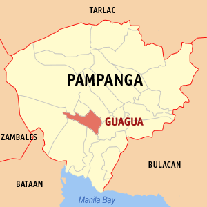
mapsize =
map_caption = Map of Pampanga showing the location of Guagua
mapsize1 =
map_caption1 =
pushpin_
pushpin_label_position =
pushpin_map_caption =
pushpin_mapsize =
subdivision_type = Country
subdivision_name =Philippines
subdivision_type1 = Region
subdivision_name1 =Central Luzon (Region III)
subdivision_type2 = Province
subdivision_name2 =Pampanga
subdivision_type3 = Districts
subdivision_name3 = 2nd District of Pampanga
subdivision_type4 =Barangays
subdivision_name4 = 31
government_type =
leader_title = Mayor
leader_name = Ricardo S. Rivera
leader_title1 = Vice Mayor
leader_name1 = Anthony S. Twano
established_title =
established_date =
established_title2 =
established_date2 =
established_title3 =
established_date3 =
area_magnitude =
unit_pref =
area_footnotes =
area_total_km2 = 66.16
area_land_km2 =
area_water_km2 =
area_total_sq_mi =
area_land_sq_mi =
area_water_sq_mi =
area_water_percent =
area_urban_km2 =
area_urban_sq_mi =
area_metro_km2 =
area_metro_sq_mi =
population_as_of = 2000
population_footnotes =
population_note =
population_total = 263971
population_density_km2 = 3989
population_density_sq_mi =
population_metro =
population_density_metro_km2 =
population_density_metro_sq_mi =
population_urban =
population_density_urban_km2 =
population_density_urban_sq_mi =
timezone = PST
utc_offset = +8
timezone_DST =
utc_offset_DST =
latd=15 |latm=9 |lats= |latNS=N
longd=120 |longm=35 |longs= |longEW=E
elevation_footnotes =
elevation_m = 18.0
elevation_ft =
postal_code_type =
postal_code =
area_code = 45
blank_name =
blank_info =
blank1_name =
blank1_info =
website = [http://www.guagua.gov.ph/ Official website of the Municipality of Guagua, Pampanga]
footnotes =Guagua is a first-class municipality in the province of Pampanga,
Philippines . According to the 2000 census, it has a population of 96,858 people in 18,438 households. With an annual rate of population increase of 2%, this town is expected to have a population of 111,259 by year 2007.The town of Guagua belongs to the Second District of Pampanga, along with the towns in the southwestern part of the province. It is about 9.5 kilometers off the capital city of San Fernando and 77 kilometers away from Metro Manila. The town is bounded on the north by the towns of Bacolor and Sta. Rita; on the south by the towns of Sasmuan and Lubao; on the east, Macabebe and Sasmuan; and on the west, Porac and Floridablanca.
History
"Wawa" which means "mouth of a river" or "alua or bukana" in the vernacular, was the original name of the town of Guagua as first known in the year 1590. Evidently, the town is strategically located along a river which played a vital role in trade and transportation in the early eras.
Guagua was already a prosperous settlement way before the Spaniards came to take control of the town in the year 1561. Indeed, there were archeological artifacts excavated in a nearby town which affirmed a pre-historic community in Guagua.
Early inhabitants opted to stay in the town because it was here that they could engage in barter trade with people from different islands, along with other means of livelihood like fishing and farming. The navigable river with which the town was endowed allowed shipping vessels to transport commodities to and from other chief localities, particularly the imperial Manila. The first cargo boat to arrive in Guagua was the "Doña Dominga" on
May 7 ,1884 . Much later it was followed by the steamships "Kaibigan" and "Kababayan," which anchored at the pier in Bo. Sto. Niño, better known as the Yangco Landing.In 1892, when the Manila-Mabalacat railroad was inaugurated, Guagua was virtually the port of embarkation to and from Manila that served the province. Commerce was further improved when the San Fernando-Guagua line of the railroad was chartered on
November 17 ,1907 .The Chinese people have long been part in Guagua's social and economic mainstream. In the 18th century, they sought refuge in the town to escape Spanish atrocity in Manila. After their near total slaughter, the Chinese lived in relative peace while they freely practiced their craft and mingled hand-in-hand with the local residents. The Chinese residents were merchants, masons, woodcarvers, carpenters, agriculturists, and laborers. Their influence on the cultural and economic life of Guagua cannot be overlooked. The town could not have prospered so readily without the Chinese' economic services.
The town took significant part in the revolutionary struggles against the foreign intruders. A house near the Catholic Church was made a secret cell of the Katipuneros in August 1897. In March 1898, all Spaniards in Guagua were murdered marking the end of Spanish colonialism, and the outset of American rule. Moreover, during the Philippine-American War and the ensuing 2nd World War, Guagua became an important battleground.
At the turn of the 20th century, a new system of education was introduced and made popular and available to the Filipinos. The Guagua Elementary School in Bo. Sta. Filomena, is believed to be the first to be established in the town in the year 1901. Later in that year, an English teacher came to Betis area and opened a primary school which functioned on a regular basis. In 1908, Colegio del Sagrado Corazon de Jesus (now St. Mary's Academy in Bo. San Roque) was established in a two-storey building donated by a charitable matron, in downtown Guagua. Later in 1918, Guagua National Institute (now Guagua National Colleges in Bo. Sta. Filomena) was founded at the convent of the Catholic Church. Further, in 1941, the then parish priest, felt the need for another high school in town, so he opened Saint Michael's College.
At the rebirth of Philippine democracy in 1986, the local government carried out the "Integrated Approach Towards Sustainable Development" to rectify its destitute state. The program gained several outstanding citations for its momentous achievement. From a mere "third class" standing in 1986, Guagua has grown to become a "first class" municipality. The sound fiscal status and effective governance brought forward translated to better and effective public service, and made Guagua a consistent recipient of several "Most Outstanding LGU" awards. All this, despite immense threat brought about by the eruption of Mount Pinatubo.
Barangays
Guagua composed of 31 jurisdictional units or barangays. For political and economic purposes, it is subdivided into four (4) sectoral areas, to wit:
*Poblacion Area
**Bancal
**Plaza Burgos
**San Nicolas 1st
**San Pedro
**San Rafael
**San Roque
**Sta. Filomena
**Sto. Cristo
**Sto. Niño
*Pangulo Area
**San Vicente
**Lambac
**Magsaysay
**Maquiapo
**Natividad
**Pulungmasle
**Rizal
**Ascomo
**Jose Abad Santos (Siran)
*Locion Area
**San Pablo
**San Juan 1st
**San Jose
**San Matias
**San Isidro
**San Antonio
*Betis Area
**San Agustin
**San Juan Bautista
**San Juan Nepomuceno
**San Miguel
**San Nicolas 2nd
**Sta. Ines
**Sta. UrsulaPhysical Characteristics
"Topography and Land Features " The town is almost flat and is suitable to any phase of development; agricultural, industrial, commercial and others. It is only a meter above sea level. The general slope is south and southeast toward the Bay of Pampanga ("Bahía de Pampanga" in Spanish) which drains out into Manila Bay. Further, Guagua is traversed by several creeks and tributaries during rainy days, which collect and convey floodwater to the Guagua river and into the Manila Bay.
"Climate" The climate prevailing in Guagua, like in other parts of Pampanga is Type I - District, wet and dry seasons. The dry season starts from December until May, with the months of March, April and May as the driest and hottest. Upon the other hand, wet season occur from June to November, in which period the rain are heaviest.
"Soil Types and Fertility" In general, the soils of Guagua are of recent alluvial origin consisting of fine sand, silt loam and hydrosol. The average chemical analysis of its top soils is : nitrogen, 0.02 to 0.1; phosphorus, 0.06 to 0.28; potassium, 0.46 to 1.74; organic carbon, 0.41 to 3.02; and pH value (acidity and alkalinity), 5.61 to 6.99
"Timber, Mineral and Non-Mineral Resources"Guagua, being a non-mountainous community is not graced with either timber, mineral and non-mineral resources. The town's needs on these materials come from outside sources.
"Flora and Fauna" The climate and topographical features of the vast land of Guagua make it ideal for the growing of fruit trees and vegetables. Among the fruit trees most fitting to be planted are mangoes, guavas, santol, star apples, and bananas. For vegetables, sitao, upo, ampalaya, gabi and cucumber are the most commonly produced by farmers and which thrive best in the community.
Being void of forest areas, its fauna are mostly the domesticated ones like, chicken, ducks, cattle, and others.
References
External links
* [http://www.guagua.gov.ph/ Official website of the Municipality of Guagua, Pampanga]
* [http://www.nscb.gov.ph/activestats/psgc/default.asp Philippine Standard Geographic Code]
* [http://www.t-macs.com/kiso/local/ 2000 Philippine Census Information]
* [http://www.gnc75.com Guagua National College Alumni Web site for Batchmates of 1975]
* [http://www.gnc.edu.ph Guagua National Colleges Website]
* [http://www.gncalumni.page.tl Guagua National Colleges Alumni Website]
Wikimedia Foundation. 2010.