- Frederick Douglass Square Historic District
-
Douglass, Frederick, Square Historic District

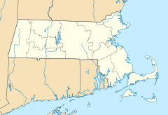

Location: Boston, Massachusetts Coordinates: 42°20′9″N 71°5′4″W / 42.33583°N 71.08444°WCoordinates: 42°20′9″N 71°5′4″W / 42.33583°N 71.08444°W Architect: Pope, George W.; Connolly, Benjamin J., et al. Architectural style: Second Empire, Queen Anne, Gothic Governing body: Local NRHP Reference#: 96001063
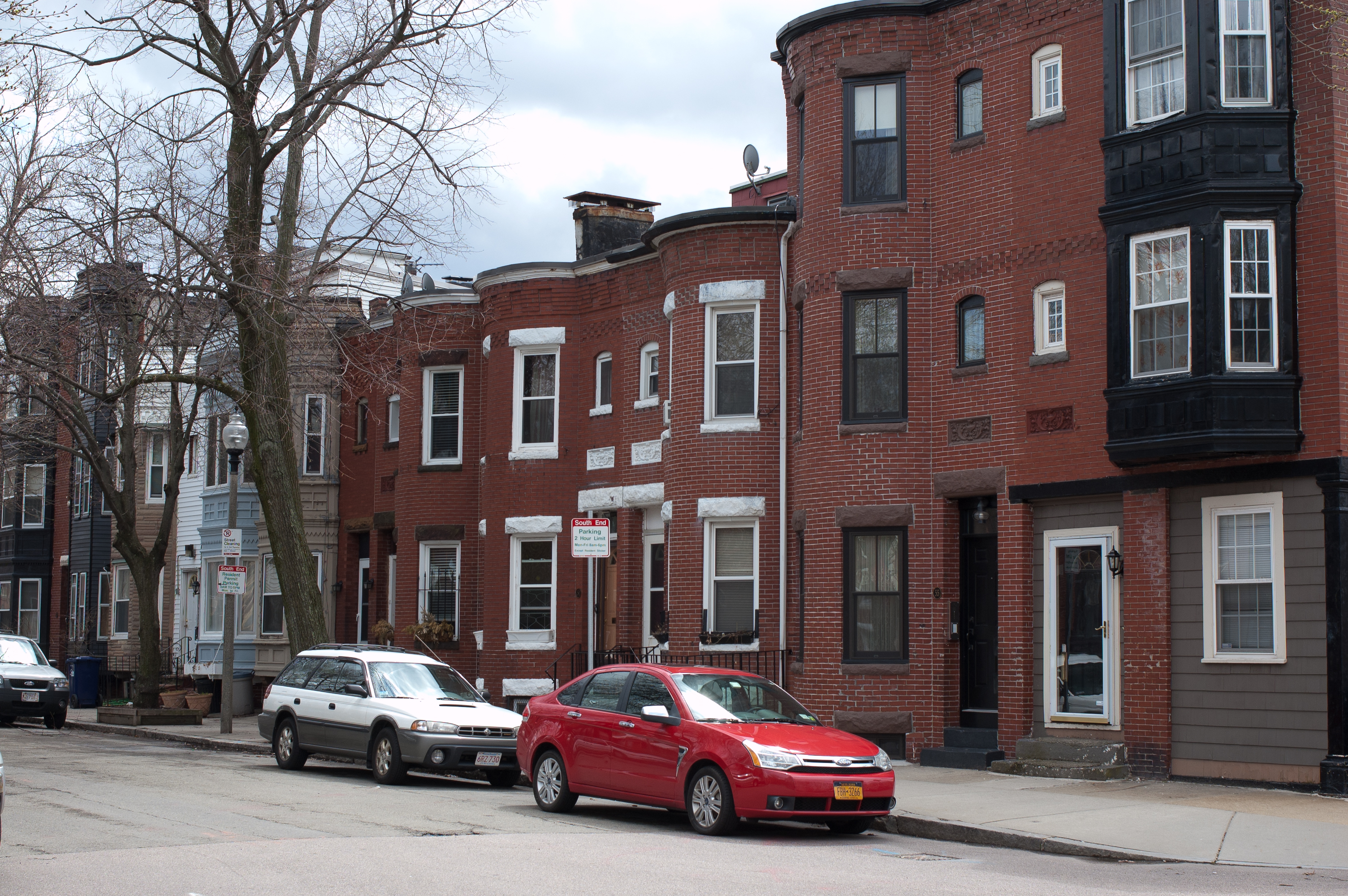
[1]Added to NRHP: October 3, 1996 Frederick Douglass Square Historic District is a historic district roughly bounded by Hammond Street, Cabot Street, Windsor Street, and Westminster Street, Lower Roxbury in Boston, Massachusetts.
The district was added to the National Register of Historic Places in 1996.
References
- ^ "National Register Information System". National Register of Historic Places. National Park Service. 2008-04-15. http://nrhp.focus.nps.gov/natreg/docs/All_Data.html.
U.S. National Register of Historic Places Topics Lists by states Alabama • Alaska • Arizona • Arkansas • California • Colorado • Connecticut • Delaware • Florida • Georgia • Hawaii • Idaho • Illinois • Indiana • Iowa • Kansas • Kentucky • Louisiana • Maine • Maryland • Massachusetts • Michigan • Minnesota • Mississippi • Missouri • Montana • Nebraska • Nevada • New Hampshire • New Jersey • New Mexico • New York • North Carolina • North Dakota • Ohio • Oklahoma • Oregon • Pennsylvania • Rhode Island • South Carolina • South Dakota • Tennessee • Texas • Utah • Vermont • Virginia • Washington • West Virginia • Wisconsin • WyomingLists by territories Lists by associated states Other This article about a National Register of Historic Places listing in Suffolk County, Massachusetts is a stub. You can help Wikipedia by expanding it.